Sunday, October 30, 2005

Scientists complete map of genetic differences - Science News

http://www.sciencenews.org/articles/20051029/fob5.asp
SNPs Ahoy! Scientists complete map of genetic differences
Christen Brownlee

Researchers have long known that complex diseases such as cancer and heart disease have genetic components that heavily affect their onset, progression, and response to treatment. But because these conditions involve many different genes interacting with each other as well as with factors in a person's environment, teasing out these elements has been difficult.
A newly completed map that plots where small genetic differences can exist among people may be a powerful tool for figuring out why some individuals get certain diseases and even for custom designing treatments.
Each person's DNA is composed of enormous sequences of four building blocks that go by the letters A, T, G, and C. The vast majority of these sequences are the same in all people, but about 0.1 percent of these letters differ from person to person and can affect an individual's risk of disease or response to drugs.
A common type of variation is a trade of one letter for another, known as a single-nucleotide polymorphism (SNP, pronounced "snip"). Scientists estimate that there are about 10 million locations for SNPs in the approximately 3 billion letters that make up the human genome.
Previous studies have shown that groups of SNPs on chromosomes tend to be inherited within clumps of 10,000 to 20,000 letters, known as haplotypes. Thus, says Peter Donnelly, of the University of Oxford in England, surveying just a small number of SNPs could tell researchers the sequence of many other letters that surround them. Comparing haplotypes in healthy and sick people could help researchers nail down which genes are associated with diseases.
"It's as if you knew there were a group of five people who always took the same bus to work," Donnelly explains. "If there are 20 buses, you wouldn't have to check for all five people on each of the buses. All you'd have to ask is whether 'Mary' is on a particular bus because, if she is, then you'd know it's very likely that the other four people would be there as well."
Three years ago, several teams of scientists around the world, including one team led by Donnelly, began an effort to map the position of 1 million SNPs in the human genome and to identify haplotypes associated with them. To start their study, known as the International HapMap Project, the researchers extracted DNA from the blood of 296 volunteers from Nigeria, China, Japan, and the United States. Pilot studies had shown that these populations carry the majority of different haplotype variations found in people.
By systematically inspecting SNPs at about every 5,000-letter interval in the volunteers' DNA, the researchers constructed a detailed map of places where variations typically occur along each of a person's 46 chromosomes. The completed map is published in the Oct. 27 Nature, and all data from the project are publicly available online (http://www.hapmap.org/). Studies to survey the DNA of volunteers from other populations around the world for additional SNP sites are in the works.
With the newly completed HapMap, "the power of the modern genomic tool kit is breathtaking," says David Goldstein of Duke University in Durham, N.C., in a commentary that accompanies the Nature article.
"In a few years, we have gone from knowing almost nothing that could be characterized as genomic ... to having complete genome sequences for many organisms, and now a nearly complete catalog of the common genetic differences among people," Goldstein says.
The next challenge for researchers will be to take HapMap's raw data and translate it into novel, genome-based ways to fight disease.

Friday, October 28, 2005

Europe's four models - Christian Science Monitor /

There is no single European social benefits model. According to Brussels Free University economics professor André Sapir, there are four models.
In a briefing paper prepared for EU finance ministers prior to Thursday's Hampton Court summit, Mr. Sapir outlined the models, and argued that only the Anglo-Saxon and Nordic models are economically sustainable.

Anglo-Saxon - (Britain, Portugal, Ireland) This model features social assistance as a last resort. It's characterized by free markets, relatively less protection from firing, but vigorous measures to help unemployed find work. Health and other benefits are attached to employment, even for low-income jobs.
Many analysts say Britain has moved to an "Anglo-social" model, a hybrid of the Anglo-Saxon and Nordic models.

Nordic - (Finland, Sweden, Denmark, Austria, and the Netherlands) This model is marked by high taxes, and high spending on education, research, universal healthcare, child care, maternity leave, and welfare. It features less job protection, but higher employment rates than Continental and Mediterranean models. A strong social safety net lowers the risk of poverty.

Continental - (France, Germany, Belgium, Luxemburg). This social support model relies on state insurance-based benefits and pensions. Poverty is fought by protecting workers from being fired. Unemployment benefits are less generous than the Nordic model. Labor union membership is declining but still influential.

Mediterranean - (Italy, Spain, Greece) This model concentrates social spending on old-age pensions. It's characterized by strong protections against firing workers and generous early retirement plans. Unemployment and poverty rates are higher than other models.
Source: Bruegel, an EU-funded think tank in Brussels.

Tuesday, October 25, 2005

Human flu pandemic 'inevitable' - BBC

No need to panic before it's time... There has been very few casualties worldwide so far. Most of them come from contacts with poultries. I live in a country where some bird flu outbreaks have occured for the past 2 years. The media is right about warning that a pandemic will eventually happen. However, very few journalists dare to say that nobody knows when this pandemic will really become deadly. So far, it makes more sense to be concerned about the effects of tobacco, alcoholism, bad nutrition, HIV/AIDS, road accidents etc.
Here are the useful websites for flu prevention:
http://www.who.int/csr/disease/avian_influenza/avian_faqs/en/index.html
http://www.cdc.gov/flu/avian/gen-info/facts.htm

Sailom


A pandemic would be caused by the H5N1 virus in birds, officials say


http://news.bbc.co.uk/2/hi/americas/4373774.stm


Last Updated: Tuesday, 25 October 2005, 05:39 GMT 06:39 UK
E-mail this to a friend
Printable version

Human flu pandemic 'inevitable'
By Lee Carter BBC News, Ottawa

Health ministers and top officials from more than 30 countries have started a conference in Ottawa, Canada, about how to plan for a human influenza pandemic.
All the speakers acknowledged that a pandemic caused by the deadly H5N1 virus was inevitable.
Strategies on how to deal with the problem are opening up sensitivities between wealthy countries and the developing world.
Wealthy nations can afford to stockpile antiviral drugs and poorer ones cannot.

H5N1 BIRD FLU VIRUS
Principally an avian disease, first seen in humans in Hong Kong in 1997
Almost all human cases thought to be contracted from birds
Possible cases of human-to-human transmission in Hong Kong, Thailand and Vietnam, but none confirmed
Q&A: Bird flu
Bird flu jab shows promise
Impact on birds and humans

World Health Organization Director General Jong-wook Lee said that countries could not let national boundaries get in the way of combating any future pandemic.
But that is clearly the fear among delegates here.
Some countries, including Mexico, are proposing that 10% of all antiviral drugs produced in wealthier countries be automatically handed over to developing ones.
In his strongest statement yet on the issue, the host of the meeting, Canadian Health Minister Ujjal Dosanjh said that countries could not be blamed for breaking patent laws if the alternative was watching their people die.
There is a similar debate about the production of any future vaccine, which some experts say could be six months away.
Some countries have proposed that the only way to increase capacity and keep costs down is to hand over production to the developing world.
E-mail this to a friend
Printable version
LINKS TO MORE AMERICAS STORIES

Monday, October 24, 2005

Wilma's Rage Suggests New Hurricane Categories Needed - Live Science


http://www.livescience.com/forcesofnature/051020_hurricane_winds.html


Wilma's Rage Suggests New Hurricane Categories Needed

By Ker ThanLiveScience Staff Writerposted: 20 October 200504:12 pm ET

In a season that has included three Category 5 hurricanes for the first time on record in the Atlantic Basin, scientists are beginning to wonder if their rating system is adequate, LiveScience has learned.
On the Saffir-Simpson hurricane scale, there is no Category 6. But Hurricane Wilma this week brushed up against where a 6 would be if the scale were logically extrapolated to include another category.
And hurricanes are getting stronger, apparently fueled by global warming. Researchers expect that trend to continue.
Kerry Emanuel, a climatologist at the Massachusetts Institute of Technology, calls the Saffir-Simpson scale irrational, in part because it deals only with wind. "I think the whole category system needs serious rethinking," Emanuel told LiveScience.
But in a telephone interview, the 88-year-old co-creator of the scale, Herbert Saffir, defended it as simple and useful for the public.
"As simple as it is, I like the scale," Saffir said today. "I don't like to see it too complex."

The history of the scale


In 1967, the United Nations commissioned Saffir, a Florida consultant engineer, to study low-cost housing in regions of the world that were prone to tropical cyclones and hurricanes.
Saffir realized there was no way to describe the effects of a hurricane, so he developed his own five-category scale. Later, Robert Simpson, then director of the National Hurricane Center, modified Saffir's work, adding measurements for flooding and storm surge.
The result was the Saffir-Simpson Hurricane Rating scale.


Saffir-Simpson Scale
Category
Winds (mph)
Storm Surge (feet)
1
74-95
4-5
2
96-110
6-8
3
111-130
9-12
4
131-155
13-18
5
155 +
18 +
LiveScience / SOURCE: NHC

A Category 1 storm begins at 74 mph and a Category 5 at 156 mph. On average, there is about a 20 mph increment in wind speed between the categories.
An extrapolation suggests that if a Category 6 were there, it would be in the range of 176-196 mph. Hurricane Wilma, which had maximum recorded wind speeds of 175 mph, would have been on the verge of breaking into this hypothetical new category.
The scale didn't include a Category 6 for two reasons.
First, it was designed to measure the amount of damage inflicted by a hurricane's winds, and beyond 156 mph, the damage begins to look about the same, according to Simpson.
"When you get up into winds in excess of 155 mph you have enough damage," Simpson said in a 1999 interview with the National Weather Log, a publication of the National Oceanic and Atmospheric Administration.
"If that extreme wind sustains itself for as much as six seconds on a building it's going to cause rupturing damages that are serious no matter how well it's engineered. So I think that it's immaterial what will happen with winds stronger than 156 miles per hour. That's the reason why we didn't try to go any higher than that," Simpson said.
Another reason is that Category 5 hurricanes are relatively rare, or at least they used to be.
"In general, I didn't expect that there would be too many hurricanes that went [above] 155 miles per hour for sustained winds," Saffir said. "The limit seems to be about 175 miles per hour and I don't know of anything that goes much over that."
Some scientists predict, however, that the intensity of hurricanes and their maximum wind speeds may be increasing and that Category 4 and 5 storms will become more common in the years to come.


Behind the beast


Ocean and atmospheric temperatures work together to determine the maximum wind speed attainable. This value is known as the "maximum potential hurricane intensity" and is calculated using a formula developed in 1998 by Emanuel, the MIT climatologist.
Based on ocean and atmospheric conditions on Earth nowadays, the estimated maximum potential for hurricanes is about 190 mph.
This upper limit is not absolute, however. It can change as a result of changes in climate. Scientists predict that as global warming continues, the maximum potential hurricane intensity will go up. They disagree, however, on what the increase will be.
Emanuel and other scientists have predicted that wind speeds—including maximum wind speeds—should increase about 5 percent for every 1 degree Celsius increase in tropical ocean temperatures.
Chris Landsea, a meteorologist at the National Hurricane Center, disagrees.
Landsea believes that even in the worst-case global warming scenarios, where global temperatures ratchet up by an additional 1-6 degrees Celsius, there would be about a 5 percent change, total, by the end of the 21st Century. That means that hurricane-force winds are unlikely to exceed 200 mph, Landsea said.
The fastest "regular" wind that's widely agreed upon was 231 mph, recorded at Mount Washington, New Hampshire, on April 12, 1934. During a May 1999 tornado in Oklahoma, researchers clocked the wind at 318 mph.


Time for a new scale?


Some scientists believe that the Saffir-Simpson scale is too simplistic and that it should either be extended or replaced.
"A rational scale would have equal increments of either the wind speed squared or the wind speed cubed," Emanuel said today. "There's nothing like that [with the Saffir-Simpson scale], it's all over the place. I think it will ultimately be revised."Other critics have pointed out that the Saffir-Simpson scale doesn't take into account a hurricane's size or the amount of rainfall.
The rains associated with some hurricanes can lead to flooding that causes just as much or more death and damage than wind.
A hurricane's size can also make a large difference in the amount of damage it inflicts. Hurricane Katrina, which was a Category 5 storm before weakening prior to landfall, caused much more damage than Camille—another Category 5 hurricane that struck in 1969. Katrina was a much larger. Katrina's hurricane-force winds extended 105 miles from its center while Camille's only extended 60 miles out.
Emanuel says a new hurricane rating system will need to have at least three numbers, describing not only wind speed, but also rainfall and storm size.
"It will also be continuous, so you can have a category 4.6 or 4.7, and it will be open-ended, so that the categories just keep going up," Emanuel said.


Saffir says: Keep it simple


Adding too many variables into a rating system would make it too complex, Saffir said. Part of the reason that the Saffir-Simpson scale has lasted so long is because it is easy for the public to grasp.
"Every hurricane is different," Saffir said today, "so you really couldn't categorize every type of hurricane as far as size and extent. As far as rainfall goes, we already have a scale for rainfall; it's measured in inches and I think that's really all that's needed."
But some critics argue that the simplicity of the scale often comes at the price of accuracy.
A new hurricane rating system might indeed become too complex for the public to easily understand, but in a way, the public doesn't have to understand it, Emanuel said.
"If you just think about it, the public's not directly involved in the decision to evacuate based on weather forecasts. In the case of Katrina, the mayor of New Orleans said, 'Get out.' It's important that the mayor and his associates or emergency managers understand the three numbers, but it's not so important that the public does."

What is the Evidence for Global Warming? - Texas A&M University

What is the Evidence for Global Warming?


Average surface temperature of earth. From Observed Climate Trends.


The plot above shows that earth surface is warming. Now let's look at the evidence used to make the plot.

1. Where do we get our information?

On land, temperature is measured a hundreds of weather stations, somewhat unevenly distributed around the world, and on some oceanic islands.


Map of land stations in the Global Historical Climatology Network where air temperature was measured on land and islands. From: NOAA National Climate Data Center.


2. At sea, we get data from satellites and from ships. Satellite measurements of surface temperature come primarily from the Advanced Very High Resolution Radiometer (AVHRR) first launched in 1978 and operated continuously since then. The satellite data are calibrated using ship observations of surface temperature from the same time and place. Accuracy of the combined ship and satellite data set, the Reynolds Optimum Interpolation Sea-Surface Temperature maps is about +- 0.3 degrees C on a one-degree (horizontal) grid.

3. Data from the AVHRR are available with horizontal resolution of about 1 km. Such maps show much more detail than the Reynolds maps. For example, look at a map of sea-surface temperature in the Gulf of Mexico produced by the Johns Hopkins University Applied Physics Laboratory, Ocean Remote Sensing Group.lick on a few of the thumbnails to bring up the image.
--> How was the map made?
--> What problems might we have if we tried to determine average temperature of the ocean before satellites were available, by using data from ships?
--> To learn more, look at the sample images of the Gulf Stream.

4. Before 1978, all observations at sea were made from ships using thermometers to measure water samples collected in buckets (bucket temperature) or to measure water drawn into the ship to cool the engines (injection temperature). Approximately 185,000,000 observations have been collected, evaluated, and tabulated through the International Comprehensive Ocean Atmosphere Data Set (ICOADS) for the period 1784 to 2002. The data set is the monthly summaries of the observations. The monthly time series are available at 2-degree (1800-2002) and 1-degree (1960-2002) spatial resolutions. Very few observations are available before about 1850, and most are from 1900.


Number of reports of marine weather reports each year included in the International Comprehensive Ocean-Atmosphere Data Set (From NOAA Climate Diagnostics Center).


For more information on measurements of water and air temperature at sea read the page on measurements of sea surface temperature in Climate Change 2001: The Scientific Basis by the Intergovernmental Panel on Climate Change.

Sources of error.
Several sources contribute errors to the plot of earth's surface temperature temperature.


1. One important error is due to the large variability in the the land and ocean temperature from region to region and month to month. Temperatures on land vary up to approximately 15-20 degrees C during the day at mid latitudes, and by up to approximately 50 degrees C from summer to winter. Over the oceans, the range is much smaller, approximately 7 degrees C from summer to winter.

2. The biggest error in the calculation is called the sampling error. We do not have enough measurements to determine if temperature is changing before about 1850, and we barely have enough even today. The error leads to some the year-to-year variability in the plot of global averaged surface temperature as as a function of time. Also read about the sampling error in oceanography (scroll down to find the box on sampling error.

3. Smith and Reynolds report that the 95% confidence uncertainty for the near-global average is 0.48C or more in the nineteenth century, near0.28C for the first half of the twentieth century, and 0.18C or less after 1950.

4. Instruments have some error. For example, water in buckets made of canvas used from 1900 to 1940 cooled off quickly compared with water in wooden buckets used before 1900. This introduced systematic, small errors into global averages of sea-surface temperature. See Box 2.2: Adjustments and Corrections to Marine Observations in measurements of sea surface temperature and ocean air temperature in Climate Change 2001.

Evidence from the past 400,000 years.

The instrumental record based on direct measurements of temperature made by thermometers and satellite instruments goes back only a hundred and fifty years. To learn about more about earlier climate change we need to use proxy data, measurements of phenomena that depend on climate. Various types of proxy data are used:

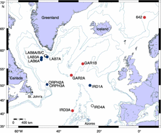
1. Cores of the sea floor made by the Integrated Ocean Drilling Program IODP. For example, Expeditions 303 and 306 collected data on climate variability in the North Atlantic over tha past few million years. The data will be used with cores from the Greenland Ice Sheet.


Location of proposed drill sites. Blue circles = primary sites planned for Expedition 303, red circles = primary sites planned for Expedition 306, and open circles = alternate sites. From Expeditions 303 and 306 Scientific Prospectus, Introduction.


2. Ice cores from thick ice sheets in Greenland, Antarctica, and mountain glaciers from around the world provide many different types of data:


Location of Greenland ice cores. From North Greenland Ice Core Project.


a. The layers give the age of the ice. For the latest ten thousand years of longer, counting the layers gives age.


Here is a photo of ice in a core collected by from the North Greenland Ice Core Project showing annual layers of the ice from about 1800 m depth, which means the ice is about 20 000 years old.The curve shows the variations in light intensity measured by a line scanner showing the light intensity scattered from the ice. This picture will be a part of Søren Wedel Nielsen's Master's Thesis. From North Greenland Ice core Project, photos from 2001.


b. Stable isotopic composition, especially the ratio (18O/16O) where 18O is the concentration of the oxygen 18 isotope, and 16O is the concentration of oxygen 16 isotope. The ratio gives temperature at which H2O condensed as water or snow.
c. Air bubbles trapped in the ice gives atmospheric gas content, especially the concentration of carbon dioxide.
d. Dust content in the ice depends on windiness over land upwind of the ice sheet.
e. Salt content in the ice depends on windiness over the ocean upwind of the ice sheet.
f. Sulphuric acid content of the ice depends on volcanic activity.
g. Learn more about evidence collected from ice cores by reading Deciphering Mysteries of Past Climate From Antarctic Ice Cores.
h. Finally, look at the graph of climate change over the past 400,000 years from the Vostock Ice Core from Introduction to Climate Change to see how data from one ice core was used to reconstruct the climate in Antarctica.

3. Dendrochronology uses measurements of the width of tree rings to determine relative changes in environmental conditions influencing the growth of trees. Change sin width provide information on droughts and temperature changes. See also dendrochronology at the Minnesota State University's E-Museum.

4. Analysis of pollen deposited in layered sediments in lakes gives the type of plants growing in the vicinity of the lake at different times. Types of plants depends on climate, and their types and abundance give information about past climates.

5. Look at the data and how data are collected at NOAA's Paleoclimate web site, beginning with the Instrumental Record for the past 100 Years.

6. Then read the Paleoclimate Data for the Last 1000 Years.

7. Then read about Paleoclimate Data for Before 1000 Years Ago.

Here are a few more plots: Global-average Surface Temperature, Average US Temperature, Many Maps of Temperature Trends.

Your brain's sex can make you ill - BBC

Male and female brains look and work differently


http://news.bbc.co.uk/1/hi/health/4365540.stm


Last Updated: Sunday, 23 October 2005, 22:56 GMT 23:56 UK
E-mail this to a friend
Printable version

Your brain's sex can make you ill

By Michelle Roberts BBC News health reporter

Scientists say they have proof that the sex of the brain makes men and women more prone to different diseases.

Doctors know that women are more likely than men to have depression, anxiety or an eating disorder, while men are at higher risk of Parkinson's disease.
Post-mortem and brain imaging studies show that male and female brains are physically different.
Now scientists say they can to link the two together and suggest future disease cures may be "gender-specific".

Male or female brain?

The sex of a brain is decided in the mother's womb and depends, among other factors, on hormone levels.
Higher levels of testosterone makes a male brain and oestrogen a female one.


We should be looking at diseases as male and female
Professor Swaab
Test your brain's sex

Professor Dick Swaab from The Netherlands Institute for Brain Research in Amsterdam, said the proof for this comes from studies of transsexuals - people who know, often from a very early age, that they are born in the wrong gender body.
"The theory is that the sex difference in the sex organs develops early in pregnancy - in the first few months while in utero - while sexual differentiation of the brain occurs later in the second half of pregnancy and postnatally."
That would mean certain factors could interfere with the sexual differentiation of the sex organs and brain in an independent way because there is a time lapse between the two.
"If that was true you would expect to see female structures in male brains. That is indeed what people have found - a reversed sex difference in the brain of transsexuals."

Brain gender diseases

He said that because men and women's brains are different "we should be looking at diseases as male and female".
"There is a different sex ratio for neurological and psychiatric diseases.
"In depression, it is very clear that sex hormones are directly interfering with the stress axis in the brain.

Brain Sex Facts:


Women tend to be better at empathising - guessing other's emotions and responding appropriately


Men are generally better at systemising - investigating how a system works

"We have shown that sensitive proteins [receptors] for sex hormones are present in the cells that form the stress axis. In women there are more oestrogen receptors and in men more androgen receptors present.
"That results in higher prevalence of depression in women compared to men because the stress axis is more sensitive.
"The oestrogens are directly affecting the production of the stress peptides.
"So for the same amount of stress in the environment, women are more prone to develop depression than men."
Others have shown that hormone levels could play a part in multiple sclerosis.
Dr Carlo Pozzilli and colleagues at the University La Sapienza in Italy found that women with MS had lower levels of the male hormone testosterone throughout their monthly cycle compared to women who did not have MS.
Dr Glenda Gillies and colleagues at Imperial College London have been looking at Parkinson's Disease, which is far more common in men than in women.
"The idea is that perhaps oestrogen is being neuroprotective so that the neurones that degenerate in PD don't seem to be as susceptible to the processes in women as they are in men," she said.
By looking at rats they found this was the case to some extent.
Female rats who had their ovaries removed became just as prone to a chemically induced condition similar to PD as male rats.
When these female mice were given extra oestrogen they got back their natural protection against PD as well.
Similarly, when they took away the source of the testosterone in male rats by castrating them, the brain degeneration was lessened.
However, surprisingly, when they gave the male mice oestrogen the damage was even worse.


His n' Hers drugs


Dr Gillies said: "Administering oestrogen in the two sexes seems to have opposite effects. It may well be that there is something that has been programmed differently in the brain during early development to make it respond in a different way."
She said work suggested that oestrogen might also help prevent strokes and Alzheimer's disease, but that it was still very early days.
"Increasingly, I think we are realising that drugs have to be personalised and that one drug is not necessarily going to be the same for each individual."
She said that most of the drugs available today had been tested on men, which may mean they are not necessarily the best design for women.
Anita Holdcroft, consultant anaesthetist also from Imperial College London, agrees.
She said not only are male and female brains different, but women's brains change throughout life in relation to fluctuating hormone levels.
"That may well affect disease states and how drugs work."
She scanned the brains of women before and after they were pregnant and found the brain shrank during pregnancy.
The shrinkage was even greater if the woman had a complication of pregnancy called preeclampsia, but reversed by six months after delivery of the baby.
"We need studies to find out why these things are happening.
"It may well affect disease states and how drugs work and highlights our lack of understanding," she said.


E-mail this to a friend
Printable version
LINKS TO MORE HEALTH STORIES

Friday, October 21, 2005

Pakistan quake toll could double - ABC/BBC/Reuters


Indian Kashmiri men react after relief goods were distributed to a few earthquake survivors in Chamkot in Indian-administered Kashmir. Reuters


http://www.abc.net.au/news/newsitems/200510/s1487520.htm

Last Updated:Friday, October 21, 2005. 12:36pm (AEST)
Pakistan quake toll could double

United Nations emergency relief coordinator Jan Egeland has warned that the death toll from the earthquake that hit Pakistan and India this month could double.
Pakistan has confirmed more that 50,000 people have been killed and another 1,300 died in Indian Kashmir.
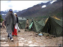
The United Nations yesterday warned of a second, massive wave of deaths unless more is done to help the estimated 3 million people with no blankets nor tents to protect them from the Himalayan winter.
Mr Egeland says a response on the scale of this year's tsunami relief operation in South-East Asia is needed.
"The tsunami was devastating. It killed more people than any other disaster in modern time," he said.
"In the Kashmir [region] we have more people inaccessible than we even had in the tsunami and we also have more people wounded than we have in the tsunami.
"Those two factors mean that we are losing more lives as the days and the weeks go by."
Mr Egeland castigated governments for being slow to give money and called on the NATO alliance to set up a "Berlin Airlift" to save people in the rugged hills of Pakistani Kashmir and North West Frontier Province.
Donor countries have pledged only $86 million so far to a UN appeal for $312 million, according to the UN official.
He says hundreds of thousands of people remain beyond reach.

Airlift

The 26-member NATO alliance was meeting on Friday to consider calls for a massive airlift to help quake survivors in Kashmir.
Washington unilaterally said last week it expected to have 40 of its military helicopters on the ground in the area in coming weeks.
Germany has already sent two of its helicopters.
With homes destroyed and belongings buried in rubble after the quake, international aid officials say the aid operation is turning into the toughest relief operation the world has known.
Aid workers say the most urgent need is for tents as people could soon start dying of exposure.
Mr Egeland says the relief effort has been complicated by differences between India and Pakistan over the disputed Kashmir region, including arguments over whether Indian helicopter pilots could fly aid missions into Pakistani areas.

-BBC/Reuters
Print Email

The Asian tsunami disaster shocked the world because it reached many big countries at the same time. It also shocked the world because it reached well-known resorts full of Western tourists.
The relatively "small" relief operations in Pakistan are in sharp contrast with the unprecedented relief operations for the tsunami victims that took place more than 9 months ago. Yet tens of thousands more people may die in Pakistan...

Sailom

Dione's Ringside Seat - Space.com / NASA

Dione's Ringside Seat


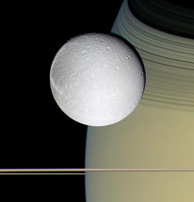
Saturn's moon Dione appears to hover over its parent planet’s rings in this color view caught by the Cassini probe during a flyby this month.
Cassini swung within 24,200 miles (39,000 kilometers) to capture this view of Dione, Saturn and the rings during its Oct. 11 flyby. The spacecraft used blue, green and infrared filters to build this image, which shows how the scene would look to a human observer.
Saturn’s rings appear beneath the icy moon of Dione as horizontal stripes, though their shadows – the black curves of the C and B rings – can be seen sweeping across the gas giant in the background at the upper right.
The colorful blues and golds of Saturn and its rings are offset by Dione’s starkness. The satellite appears no different in this color view than in monochrome images, astronomers said.
Each pixel of this image corresponds to about one mile (2 kilometers) in this image, which was photographed while Cassini was nearly in the same plane as Saturn’s rings.
-- SPACE.com Staff

http://www.space.com/imageoftheday/image_of_day_051020.html

Cracking the Code of Pre-Earthquake Signals - SETI / Space.com


http://www.space.com/searchforlife/seti_freund_quakes_051020.html


Cracking the Code of Pre-Earthquake Signals

By Friedemann Freund

Principal Investigator, SETI Institute

posted: 20 October 2005 06:39 am ET


Our Earth is a restless planet. Occasionally – quite often, in some regions of the world – the restlessness turns deadly. Of all natural hazards, earthquakes are the most feared. They are feared because they seem to strike so unpredictably. Yet, for centuries, and even millennia, people living in seismically active regions have noted premonitory signals. The historical records talk of changes of the water level in wells, of strange weather, of ground-hugging fog, of unusual behavior of animals (both domestic and wild) that seem to feel the approach of a major earthquake. With the advent of modern science and technology the list of premonitory signals has become even longer. Among them are


1. Sporadic emissions of low to ultralow-frequency electromagnetic radiation from the ground


2. Occasional local magnetic field anomalies reaching a strength of half a percent of the Earth’s main dipole field


3. Changes in the lower atmosphere that are accompanied by the formation of haze and a reduction of moisture in the air.


4. Large patches, often tens to hundreds of thousands of square kilometers in size, seen in night-time infrared satellite images where the land surface temperature seems to fluctuate rapidly


5. Passing perturbations in the ionosphere at 90 - 120 km altitude that affect the transmission of radio waves


Deciphering these signals and learning how to "read" them has remained a source of great frustration. Many seismologists have lost faith that earthquakes would ever become predictable beyond statistical probabilities, which leave uncertainties of years, even decades. Some seismologists have proclaimed categorically that, due to their chaotic nature, earthquakes are fundamentally unpredictable.


However, given so many well-supported historical and modern indicators that the Earth does indeed send out premonitory signals, the naysayers should not deter us. Maybe we do not yet understand deeply enough the nature of earthquakes and the physics of the signals that the Earth sends out.


Some ten years ago I became interested in this challenging topic. My earlier work had led me to study chemical and physical processes inside crystals, inside the matrix of gem-quality minerals, which can shed light on the origin of life. During this earlier work I had run across a peculiar reaction, which nobody seemed to have noted before, and hardly anybody seemed to care about. This reaction involves small amounts of water, H2O, which become incorporated whenever a mineral crystallizes deep in the Earth’s crust or mantle in an H2O-laden magma or any other high temperature H2O-laden environment. All these minerals, even those that do not nominally contain "water" as part of their crystallographic makeup, structurally dissolve some H2O in the form of hydroxyl, typically Si-OH, and a major part of it in the form of hydroxyl pairs, Si-OH HO-Si.


In the mid-1970s, long before I became interested in either the origin of life or pre-earthquake phenomena, I had discovered that such hydroxyl pairs inside crystals undergo a very unusual reaction. The two oxygens and two hydrogens fight over the electrons that they share, and the hydrogens win. They each take away one electron from their oxygens and turn into a hydrogen molecule, H2. The oxygens in turn pair up to form what chemists call a peroxy bond: Si-OO-Si.


For years I did not think much of this discovery, but somehow it followed me and eventually drew me into the field of geophysics and the study of the premonitory signals that the Earth sends out before major earthquakes.


Electrical rocks


We normally think of rocks as being good insulators, i.e., rocks are very poor at conducting electrical currents. However, in rocks whose minerals contain peroxy bonds, a time bomb is ticking. When these rocks are subjected to stress, the peroxy bonds break and suddenly mobile electronic charge carriers appear, so-called defect electrons that live and travel in the valence band of the constituent minerals. These charge carriers are also called positive holes or p-holes for short.


Looking back over the 30 years since their discovery, I am surprised to note that I always returned to these strange and elusive charge carriers. I tried to understand their nature and to predict their behavior. The breakthrough came when I realized that these p-holes could be activated by stress. This put me squarely on the track to study earthquake-related phenomena.
Still, it took several years and several wrong starts until I was able to conceive an experiment that is amazingly simple and, at the same time, full of surprises. In figure 1, a 1.2-meter long slab of granite which, together with my coworkers Dr. Akihiro Takeuchi and Dr. Bobby Lau, I had fitted with copper electrodes at both ends to measure currents and with a capacitor plate on the top surface to measure potentials. We inserted one end of the slab into a powerful press, but insulated it from the pistons. Then, we started to squeeze. We squeezed the rock many times and recorded the currents that started to flow out of both ends.


The experiment showed that the stressed volume of rock becomes a source of electronic charge carriers, p-holes and electrons. Since p-holes and electrons flow out in opposite directions, something important must happen at the boundary between the stressed and unstressed rock. The boundary allows p-holes to pass but blocks electrons. It therefore acts like a diode in a transistor. Obviously the unstressed granite is capable of conducting p-holes, meaning that it behaves like a p-type semiconductor. The electrons can flow out of the stressed rock volume only if there is an n-type connection – in our case the copper electrode.


Next we may wonder how long such currents can flow if we keep the load constant. We did a similar stress test with gabbro, another igneous rock. Upon keeping the load constant for 30 minutes, the two currents flow with barely any loss in their intensities. Even keeping the load constant for 12 hours leads to not more than a 15-20% reduction of the currents. This shows that, once activated, the p-holes and electrons in the stressed rock volume have a very long lifetime.


Use for earthquake prediction


How can we apply this new knowledge to earthquakes and to those hidden processes that take place deep in the Earth’s crust before tectonic stresses reach a critical level where rupture occurs and the ground starts to shake?


Though we stand only at the beginning of a long road to discoveries yet to come, we can already project some of our findings into geophysical reality.


In figure 2, you can see a sketch of a very simplified model depicting a section through the Earth’s crust where tectonic forces begin to act on a large block of strong, rigid rocks, maybe 100 - 1000 km wide, 20 km thick and 50 - 10 km in the thrust direction. As stresses build up from the left, they cause plastic deformation propagating toward the right. The volume of rocks undergoing deformation becomes the source of p-holes and electrons. The p-holes can flow out horizontally. The electrons can flow out only if they can connect downward into the deeper, hotter and, hence, n-type conducting portions of the lower crust.


In this model we obviously neglect to take into account the role of water which fills faults that deeply dissect the Earth’s crust in all tectonically active regions. Faults filled with water or brines will introduce complications, but we already know from laboratory experiments that water may short-circuit the p-hole conduction through the rocks but it does not "kill" it. Therefore we can cautiously go ahead and project some of the consequences of the p-hole activation in rocks that experience ever-increasing levels of stress.


One of these consequences is that the p-hole current flowing horizontally through the crust should couple to the electron current flowing downward. The coupling is provided by their respective electric fields. As a result both currents can be expected to fluctuate just like the p-hole and electron currents did in our laboratory experiments. Fluctuating currents are a source of low frequency electromagnetic (EM) radiation. Thus our model, simple as it may be, points to the possibility that the often reported pre-earthquake low frequency EM emissions arise from ground currents flowing deep in the Earth’s crust. The ground currents may be very powerful. For instance, taking the currents flowing out of the squeezed end of the granite slab in our experiment, we may ask what would be the current flowing out of a cubic kilometer of granite or gabbro in the crust, all other conditions being the same. The answer is a surprisingly large value, somewhere between 100,000 and 1,000,000 amperes. Since huge volumes of rocks – tens of thousands of cubic kilometers – come under increasing stress during the build-up of large earthquakes, the ground currents could indeed be enormous. Looking at it from a different perspective, we can say that, even if most of the currents generated in the ground are short-circuited or annihilated by other factors, those that remain might still reach impressively large values.


Atmospheric disturbances


Another result of stress-activated currents flowing in the ground would be that some p-holes will reach the surface of the Earth. They would change the ground potential over large areas, making it more positive relative to the surrounding areas. This would have many consequences, of which I only want to mention one.


Roughly 90 - 120 km above the Earth’s surface the ionosphere begins, which is composed of a highly dynamic plasma of electrons and ions generated under the daily assault of extreme ultraviolet radiation from the Sun, solar wind bombardment, and cosmic rays. If the land surface below becomes increasingly positive, this plasma sheet will react. Maybe the source for the well-documented pre-earthquake ionospheric perturbations lies in the activation of p-holes deep in the Earth’s crust and the mischief that they play at the Earth’s surface.


In hindsight it is quite amazing to see how a line of basic research that, at its outset three decades ago seemed to have no connection whatsoever to the origin of life and to earthquakes, has become a treasure drove of insights and discoveries. It is certainly too early to say that earthquake prediction is just around the corner. However, I feel confident that the discovery of p-holes in rocks and their activation by stress represents a crucial step toward cracking the code of the Earth’s multifaceted pre-earthquake signals.

Thursday, October 20, 2005

Lessons Not Learned: World 'Totally Unprepared' for Potential Global Disaster - Live Science


http://www.livescience.com/forcesofnature/051018_asteroid_impact.html


Lessons Not Learned: World 'Totally Unprepared' for Potential Global Disaster
By Robert Roy Britt
LiveScience Managing Editor
posted: 18 October 200503:00 pm ET

Disasters rarely come as a total surprise. At least not to the scientists who study them and the politicians who plan for them.
Yet preparations are rarely adequate. And that concerns a group of adventurers who know something about one of the deadliest potential catastrophes.
Poor responses to a recent spate of particularly deadly disasters around the world highlight the need to prepare for an asteroid impact that could be far more catastrophic, a group of astronauts and cosmonauts says.
In an open letter to world governments dated Oct. 14, the Association of Space Explorers (ASE) called recent disaster responses inadequate and noted that a major asteroid impact would likely be “predictable and preventable.”
“In most cases it is clear in retrospect that the mitigation measures were inadequate not due to lack of understanding, but due to failure to effectively act based on well understood fore-knowledge of the disaster potential,” the ASE letter states.
It is signed by astronaut John Fabian, who flew on the space shuttle in 1983 and 1985, and Russian cosmonaut Alexei Leonov. ASE counts about 300 former spacefarers from about 30 countries as members.

Unprepared for the expected

New Orleans has long been described as a disaster waiting to happen. Scientists have said for decades that a major hurricane would eventually strike, and engineers knew the levees would not hold.
Hurricane Katrina proved them right.
Katrina taught another lesson, one that had already been learned after the Sept. 11 terrorist attacks. Relief efforts along the Gulf Coast were hampered by an inability to communicate. Officials relied primarily on cell and radio towers, many of which were knocked down or simply lost power.
Earthquakes serve as another example of the human propensity to ignore warnings, as buildings in many earthquake zones, including the U.S. Midwest, are not built to withstand predicted shaking, even though the technology involved is well understood.
Last year's deadly tsunami was an event scientists have long predicted, but there was no communication system in place to warn residents of the region, even though in some cases the deadly waves did not arrive for hours.
Slow reaction can also be attributed to a lack of proper planning. Ten days after this month's earthquake in Pakistan, some half a million survivors have yet to see any sort of aid, according to the United Nations World Food Program.
Other disasters that scientists have warned we are not fully prepared for include:

New York Hurricane
Increased Rain from Global Warming
West Coast Tsunami

Greater concern

“We astronauts and cosmonauts are particularly concerned by a far more threatening natural disaster for which the world is totally unprepared; namely the future impact of a near-Earth object (NEO) with the Earth,” states the ASE letter.
Damage from an asteroid impact could range from local to regional or even global, in the case of a very large object. Such impacts are rare, and scientists say the odds are very good that a large potential impacting space rock would be spotted years if not decades in advance.
Though the chance of an impact is extremely low in any given year, the stakes are ultimately high.
“Historically the largest of such cosmic impacts have lead to the virtually instantaneous extinction of a majority of the species alive on the planet at the time of impact,” the spacefarers write.
Even a relatively small rock, which conceivably could sneak up on us, could wipe out an entire city or destroy most of a country. The economic ripple effect would be enormous, other experts have cautioned.

Not enough

NASA devotes a few million dollars each year to a limited search program that is closing in on finding all the potentially threatening large asteroids, those that could cause global extinction. But the effort leaves many thousands of smaller objects unaccounted for.
There are no firm plans by any governmental agency to deflect or destroy an incoming object. And there are also no plans to deal with the aftermath of an impact.
Like many astronomers who search for and study asteroids, the ASE members think more should be done to fund surveys and plan for possible deflection of an incoming asteroid.
From the letter: "Given the eventuality of such cosmic collisions and the emerging human capability to actually prevent them, the Association of Space Explorers calls on the governments and relevant international organizations of the world, and their respective leaders, to acknowledge this challenge and accept the responsibility for prevention of these most devastating of all natural disasters."
Meanwhile, one space rock is known to be headed our way. In 2029, asteroid Apophis will pass close to Earth. It will miss the planet, but scientists say the gravitational interaction could set it on a collision course for the future. Some researchers are calling for NASA to mount a mission to place a robot on the rock by 2014 so more can be learned in case a deflection mission is needed.

Natural Disasters: Top 10 U.S. Threats
Scientists: Natural Disasters Becoming More Common
Astronomers Gear Up for Historic Asteroid Pass in 2029
Catastrophe Calculator: Estimate Asteroid Impact Effects Online
Odds Put on Next Great San Francisco Earthquake

Spain orders arrest of US troops - BBC


The incident was a shocking end to the war for journalists


http://news.bbc.co.uk/2/hi/middle_east/4357684.stm


Last Updated: Wednesday, 19 October 2005, 15:27 GMT 16:27 UK
E-mail this to a friend
Printable version

Spain orders arrest of US troops

A Spanish judge has issued an international arrest order for three US soldiers over the shelling of a Baghdad hotel that killed a cameraman.


Judge Santiago Pedraz issued the warrant for Sgt Shawn Gibson, Capt Philip Wolford and Lt Col Philip de Camp, of the US 3rd Infantry Division.
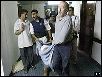
Jose Couso, of Spanish TV network Telecinco, died in April 2003 when a US tank fired on the Palestine Hotel.
Reuters news agency cameraman Taras Protsyuk, a Ukrainian, was also killed.
The National Court agreed to consider filing criminal charges against three members of the tank crew two years ago, acting on a request from Mr Couso's family.


'No co-operation'


Speaking on Wednesday, the judge said he had issued the arrest order because of a lack of judicial co-operation from the US in the case.
The family of Mr Couso said they were delighted at the news, and that they now hoped justice would be done.
US officials say the tank crew believed they were being shot at when they opened fire, although TV footage of the incident did not record any incoming fire.
The incident was witnessed on TV around the world on the day before the fall of the regime of Iraqi leader Saddam Hussein, as the Palestine was the base for almost all the foreign media crews in Baghdad.
Earlier on the same day, a correspondent for the Arabic TV broadcaster al-Jazeera was killed when US missiles hit the network's office in Baghdad.
Following the incident, then-US Secretary of State Colin Powell said a US review of the incident had found the use of force was justified.
E-mail this to a friend
Printable version

Wednesday, October 19, 2005

Florida prepares for maximum power Wilma - Times

Just one comment about Hurricane strengths.

Category 5 is the maximum hurricane strength. However this scale has a linear progression: +19 mph on average from one category to another. The lower limit of category 5 are sustained winds of 154 mph. The current sustained winds of hurricane Wilma have already reached 175 mph. That's 21 mph more...

In other words, hurricanes have recently reached such strength that a new category of storm could well be defined as category 6.

That's why you would hear in the news that Wilma is an "extremely dangerous category 5 hurricane".

Sailom

http://www.timesonline.co.uk/article/0,,23889-1833179,00.html


Times Online
October 19, 2005Florida prepares for maximum power Wilma By Sam Knight and agencies
Hurricane Wilma grew rapidly into a maximum strength, Category 5 storm this morning as it continues its erratic journey north through the Caribbean and towards Florida.
NI_MPU('middle');
Wilma, the 12th hurricane in this year's record season, is currently carrying 175mph (282 kph) winds and bringing heavy rain to Central America. The eye of the storm, which is moving north at around 8mph is 170 miles (274km) south of the Cayman Islands, off the coast of Honduras.
The storm has worsened quickly. Wilma became a hurricane yesterday and in the space of just half an hour overnight, plunged from a Category 4 storm to a Category 5 brute, the speed of its winds increasing by 65mph.
The latest advisory from the US National Hurricane Centre measured a minimum pressure of 892 millibars in the middle of the storm, the lowest on record since the Labour Day hurricane of 1935, that killed around 400 people in Florida.
"We do not know how long it will maintain this Category 5 state," said Trisha Wallace, a meteorologist at the National Hurricane Center.
Wilma's movements are being scrutinised by countries throughout the Caribbean, with predictions suggesting that the storm will strike Cuba and Florida at the end of the week.
Honduras has closed two ports and Nicaragua, Mexico and Cuba have all declared alerts as authorities hope the hurricane passes by. Wilma has already caused mudslides and one death in Jamaica.
In Florida, struck by six hurricanes last year, some residents are already buying food and water and building materials to strengthen their homes for the possible landfall of Wilma.
"It does look like it poses a significant threat to Florida by the weekend. Of course, these are four and five-day forecasts, so things can change," said Dan Brown, a meteorologist at the National Hurricane Centre.
Wilma’s track could take it near Punta Gorda on Florida’s southwestern Gulf Coast and other towns hit by Hurricane Charley, a Category 4 storm, in August 2004. Hurricanes have killed 150 people and caused more than $20 billion in damage in Florida in the last 12 months.
Wilma became the hurricane season's 21st storm on Monday, tying a record that has stood since 1933 and exhausting the list of names for the year.
On gaining hurricane-strength, Wilma became the record-equalling 12th hurricane of the season, the same number reached in 1969, and the most in a year since records began in 1851. The hurricane season ends on November 30.

Life's Building Blocks 'Abundant in Space' - Space.com

Some clues about the origins of life on Earth...

Sailom

http://www.space.com/scienceastronomy/051018_science_tuesday.html


Life's Building Blocks 'Abundant in Space'
By Bjorn CareyStaff
Writerposted: 18 October 200506:28 am ET

The idea that comets and meteorites seeded an early Earth with the tools to make life has gained momentum from recent observations of some of these building blocks floating throughout the cosmos.
Scientists scanning a galaxy 12 million light-years away with NASA's Spitzer Space Telescope detected copious amounts of nitrogen containing polycyclic aromatic hydrocarbons (PAHs), molecules critical to all known forms of life.
PAHs carry information for DNA and RNA and are an important component of hemoglobin, the molecule that transports oxygen through the body. They also make chlorophyll, the main molecule responsible for photosynthesis in plants, and – perhaps most importantly – they're the main ingredient in caffeine and chocolate.
"There once was a time that the assumption was that the origin of life, everything from building simple compounds up to complex life, had to happen here on Earth," said study leader Doug Hudgins of Ames Research Center. "We've discovered that some very biologically interesting molecules can be formed outside our earthly environment and delivered here."

Wherever there's a planet ...

While organic compounds have been discovered in meteorites that have landed on Earth, this is the first direct evidence for the presence of complex, important biogenic compounds in space. So far evidence suggests that PAHs are formed in the winds of dying stars and spread all over interstellar space.
"This stuff contains the building blocks of life, and now we can say they're abundant in space," Hudgins said. "And wherever there's a planet out there, we know that these things are going to be raining down on it. It did here and it does elsewhere."
Using the Spitzer Space Telescope, Hudgins and his colleagues detected the familiar chemical signature of regular polycyclic aromatic hydrocarbons (PAHs) in the spiral galaxy M81, as well as a similar, but unknown signature.
"There were a few anomalies in the spectrum that we couldn't explain," Hudgins told SPACE.com. The researchers compared their readings to the infrared signatures of similar molecules, finally settling on nitrogen containing PAHs because their data showed there was nitrogen in the regions they were investigating.
"When we did that, we found that by putting a little nitrogen in these molecules explained the troubling molecules," Hudgins said. "This discovery takes this reservoir of molecules that we didn't think were interesting and transforms all this stuff into something of biologic interest."

The chicken wire of life

PAHs are flat, chicken-wire shaped molecules made up of carbon and hydrogen, interesting to scientists because life on Earth is carbon-based. However, PAHs are not used in human biochemistry. In fact, they're better known as cancer-causing carcinogens and environmental pollutants.
But swap a carbon atom with a nitrogen and a PAH becomes a PANH, a class of molecules critical to humans. Without nitrogen, it would be impossible to build amino acids, proteins, DNA, RNA, hemoglobin, and many other important molecules.
Here on Earth, Nitrogen makes up 78 percent of the atmosphere and is a key member of CHNOPS – carbon, hydrogen, nitrogen, oxygen, phosphorus, and sulfur – the group of ingredients most important for making life and staples of organic chemistry.
It's also the main component of ammonia, which is used in fertilizers and explosives on Earth, but has also been detected in Jupiter's atmosphere and possibly in Titan's icy lakes.
PAHs aren't the first of life's building blocks to be discovered in space – amino acids, the nuts and bolts of proteins, have also been found in the tails of comets. Meteorites that have landed in Australia and Antarctica also contain amino acids and PAHs.
"This tells us that these things that we see out in space can survive interstellar space and successfully be delivered to the surface of a planet," Hudgins said.

Does not mean life

Some scientists even think that a Martian meteorite found in Antarctica shows signs of extraterrestrial bacteria and that sugar-loaded asteroids may have fed early life on our planet.
While PAHs are abundant in interstellar space, Hudgins says this doesn't prove that terrestrial life has extra-terrestrial origins. But, to paraphrase Occam's Razor, given two equally likely theories, choose the simpler.
"This isn't proof that they were used, but a likely suggestion," Hudgins said. "They were present in abundance at the dawn of time and could have been useful in creating the first life form."
These findings are detailed in the Oct 10 issue of the Astrophysical Journal.

Tuesday, October 18, 2005

UK scientists lead mission to Venus - Scotsman

http://news.scotsman.com/index.cfm?id=2104042005

UK scientists lead mission to Venus
EBEN HARRELL

EUROPEAN scientists will this month attempt the first trip to the planet Venus for 15 years.
In a pre-launch briefing yesterday, the European Space Agency laid out its hopes for the £150 million, unmanned mission to Earth's nearest neighbour.

The mission - Venus Express - is due to embark on its five-month journey on 26 October and scientists hope it will offer clues into how the Earth will respond to increasing greenhouse gases.
Venus, easily identifiable from Earth as the morning star, is similar in size and mass to our planet and, in relative terms in the solar system, a similar distance to the Sun.
However, Venus has 100 times the atmospheric pressure of Earth; its atmosphere is a dense cloud of carbon dioxide released through its constant volcanic activity.
Carbon dioxide and other greenhouse gases insulate the planet, heating the surface to an average temperature of 450C.
Sulphuric acid routinely rains on to a barren terrain of deserts and lava-coated mountains, and scientists believe the planet provides a stark lesson on the effects of runaway global warming.
Dr Andrew Coates, from University College London's Mullard Space Science Laboratory in Dorking, Surrey, is one of several British scientists involved in the mission. He said: "Venus is sometimes called Earth's 'evil twin' - it has some similarities like size, but big differences like hotter-than-oven temperatures, sulphuric acid clouds, crushing surface pressure, rotation the 'wrong' way around its axis - and no protective magnetic field.
"Venus Express will look at how the planet's thick atmosphere works, and how it interacts with the surface below and escapes to space above. Studying Venus, especially the runaway greenhouse effect, may give us vital lessons for the Earth's future."
The mission will orbit the planet in April 2006 and study the mysterious hurricane-like vortices above the poles. From the spacecraft, scientists will also be able to look for signs of volcanic activity.
Clues may be found from sulphuric acid and sulphur dioxide in the lower atmosphere, and shock waves sent through the clouds by the violent tremors and quakes on the surface.
A number of British institutions and companies have contributed to Venus Express. Scientists from the Rutherford Appleton Laboratory and UCL's Mullard Space Science Laboratory in Dorking, are co-investigators for an instrument called Aspera which will probe molecules and energetic particles in the atmosphere.
Experts from Imperial College London are to analyse data from Mag, the spacecraft's magnetometer, which will measure the planet's atmospheric magnetic field.
The Stevenage-based company EADS Astrium built the propulsion system which will put the spacecraft in orbit, while SciSys, from Wiltshire, provided mission control systems.
Professor Colin Pillinger, the lead scientist for the failed Beagle 2 mission to Mars in December 2003, said details of Venus's hostile conditions might help people understand the implications of extreme amounts of greenhouse gas in the atmosphere.
"Of course, on Earth we are concerned because of carbon dioxide emissions from fossil fuels. Enormous amounts of carbon dioxide in the atmosphere might turn our planet into something like Venus. So we need to understand what's happening there."
Venus Express will be blasted into space by a Russian Soyuz-Fregat rocket launched from the Baikonur cosmodrome in Kazakhstan. The same launch vehicle was used to send Mars Express on its way to the Red Planet.
In the 1970s and early 1980s, spacecraft launched by the former Soviet Union led the way in Venus exploration.
After a number of early failures, during which three spacecraft were crushed by the planet's atmospheric pressure, the USSR landed a series of Venera probes on Venus.
The probes were fitted with diamond windows to withstand the high atmospheric pressure and temperature.
The last dedicated mission to Venus was Magellan, launched by the American space agency NASA in 1990, which mapped the surface using radar.

Row mars S Asia quake aid effort - BBC


Helicopter crews are making hazardous trips into the mountains

http://news.bbc.co.uk/2/hi/south_asia/4351624.stm


Last Updated: Monday, 17 October 2005, 23:25 GMT 00:25 UK
E-mail this to a friend
Printable version
Row mars S Asia quake aid effort

Pakistan and India have failed to agree terms under which Indian army aircraft would join the search-and-rescue mission to reach earthquake survivors.
Pakistan says it will accept Indian helicopters but not crew, while India insists its pilots must fly the craft.
The dispute came as a top UN official said there were not enough warm tents in the world to protect refugees from the coming winter.
As many as 54,000 people may have died in the quake, local officials now say.
Many of the survivors are in remote mountains or deep valleys, and helicopter is the only way to reach them.


Map of earthquake zone
The BBC's Aamer Ahmed Khan in Karachi says an agreement between the historic rivals could potentially double the size of the fleet of relief helicopters operating in Pakistan and Pakistan-administered Kashmir.
Good weather has allowed helicopter relief efforts to resume, but 20% of the areas worst-hit may still not have been reached.
Ten days after the earthquake hit Kashmir and parts of Pakistan, India and Afghanistan, at least two million people are still homeless and at the mercy of the weather, aid officials warn.
India has suggested it will allow Pakistani aircraft to carry out relief operations on its side of the Line of Control in Kashmir, and offered to work on the Pakistani side.
Death toll grows
Deaths in Pakistani-run Kashmir alone may exceed 40,000, local officials say.
Sikander Hayat Khan, the regional prime minister, said he believed that up to 70,000 had also been injured.
If confirmed, the new death figures would bring the total to 54,000 in all areas affected by the quake.


Only the heaviest tents will protect against the brutal Kashmiri winter

Pakistan's government puts the overall number of deaths in Pakistan-administered Kashmir and North West Frontier Province at about 40,000.
In Indian-administered Kashmir, officials say 1,400 people were killed.
Aid workers say more are bound to die unless either they reach shelter, or shelter reaches them.
Andrew Macleod, operations manager of the UN Emergency Response Team working out of Islamabad, the Pakistani capital, said winter-weight tents were needed to protect people from the "cold and brutal winter" to come.
But he warned: "The need here is greater than the existence of tents in the world. We need more tents than exist."
He told the BBC's Newshour radio programme the problem was "outside the scope of any government to handle".
Mr Macleod said while many refugees were converging on centres like Islamabad and Rawalpindi, many others could not make such a journey, over several mountain ranges, when roads had been blocked or swept away in landslides.
"Here we've got over 15,000 villages spread out through the affected region."
"The affected areas are much larger in geographical size than the tsunami, and rather than being in flat coastal areas, we are operating in some of the highest mountains and deepest valleys in the world."


* Many roads in the affected area are damaged and/or impassable
Return to the top

Saturday, October 15, 2005

UN official accuses US of starving Iraqi civilians - ABC

http://www.abc.net.au/news/newsitems/200510/s1482944.htm

Last Update: Saturday, October 15, 2005. 9:16am (AEST)

UN official accuses US of starving Iraqi civilians

A United Nations human rights investigator has accused US and British forces in Iraq of breaching international law by depriving civilians of food and water in besieged cities as they try to flush out militants.
The US military denied the charge and said that while supplies were sometimes disrupted by combat, food was never deliberately withheld.
Jean Ziegler, a former Swiss sociology professor who is UN special rapporteur on the right to food, said the Geneva Conventions banned military forces from using "starvation of civilians as a method of warfare".
He said that in Fallujah, Tal Afar and Samarra, Iraqi and US-led forces had cut off or restricted food and water to encourage residents to flee before assaults on entrenched Sunni insurgents over the past year.
"A drama is taking place in total silence in Iraq, where the coalition's occupying forces are using hunger and deprivation of water as a weapon of war against the civilian population," Mr Ziegler said.
Two 1977 protocols to the 1949 Geneva Conventions, which lay down rules of conduct in armed conflicts, ban using deprivation of food or water as a weapon of war.
They also prohibit destruction of food stocks or interruption of food supply lines.
Mr Ziegler said he understood the military rationale of the coalition forces who were "facing such a horrible enemy - these insurgents who do not respect any law of war and who use the civilian population of cities like Fallujah or Tal Afar as human shields, who keep them as hostages".
But he said their actions were nevertheless a "flagrant violation of international humanitarian law".
Mr Ziegler said he hoped the General Assembly would "condemn this strategy of the coalition forces" when he presents his report on the right to food in New York on October 27.
Accusations 'baseless'
Lieutenant Colonel Steve Boylan, a spokesman for the US military in Iraq, said Mr Ziegler's accusations were baseless.
"Any allegations of us withholding basic needs from the Iraqi people are false," he said.
"In conjunction with our combat operations, we take all precautions to ensure that the Iraqi people are taken care of, as does the Iraqi Government," Lt Col Boylan said.
"There have in the past ... been some supplies that have been delayed due to combat operations, but they were due to transit the area once it was deemed safe. It does not do relief supplies any good if you have them going into a firefight."
Mr Ziegler said that he had been in touch with British authorities on the issue, and "a channel seems to be opening", but that attempts to start a dialogue with US authorities had been fruitless.
-Reuters
Print Email

The dawn of a new space race? - BBC

http://news.bbc.co.uk/2/hi/asia-pacific/4208176.stm
Last Updated: Friday, 14 October 2005, 09:29 GMT 10:29 UK
E-mail this to a friend Printable version

The dawn of a new space race?


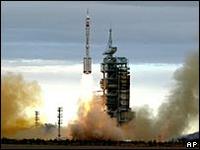
Shenzhou VI carried two Chinese astronauts into space


China's launch of its second manned spacecraft, Shenzhou VI, has confirmed the country's place among the space elite.
But as China begins planning a lunar mission in 2007, and with the US and India declaring an interest in another Moon landing - and a manned flight to Mars - are we seeing the dawn of a new space race?
"Once China had announced its first unmanned lunar spacecraft, India came along and said that they were also interested in unmanned lunar exploration," Philip Clark, of the British-based Molniya Space Consultancy, told BBC World Service's Analysis programme.
"They've now signed an agreement with the European Space Agency for joint experiments with the Indian spacecraft.
"And the Japanese have already flown their own unmanned lunar missions," he said.

Forced to go alone

While India's space programme is relatively small, it has made considerable strides in recent years, putting a number of satellites into orbit.
Dr Rodham Narasimhan, the director of India's Space Commission, said the aim of the programme had always been to develop practical civilian applications from the spacecraft.
He described these aims as "developmental - communications, remote sensing, agricultural crop production."


India has managed to develop its programme through collaboration

But, perhaps because of this, India has also been able - unlike the Chinese - to buy in expertise of other space agencies where necessary.
"We could have India and Japan pooling their resources, because the Japanese have got far more capable launch vehicles than the Indians have," Mr Clark explained.
"But the Chinese are having to basically do everything on their own," he said.
Another reason for this is the view of the Americans towards China.
Although they agreed to join forces with the Russians in the 1990s in developing the International Space Station, the Americans, Mr Clark said, still see China as a rival, not an ally.
"It's not space as such that's the problem... it's what's the Americans see as technology transfer," he said.
"They don't want the Chinese to have access to American technology, because they believe, rightly or wrongly, that any technology that the Chinese get access to will immediately be applied to the Chinese weapons programme."
US mistrust has cost China's space programme much, space analyst Brian Harvey told Analysis.
Ultimately, their attitude has effectively grounded the Chinese commercial launcher programme.
"The Americans specified that no American-built component on any satellite anywhere in the world may fly on a Chinese rocket," Mr Harvey explained.
"This means that although the international space programme is supposed to be international, and all partners are supposed to make decisions together, in fact the reality is that Americans regard it as their own territory and they won't let the Chinese anywhere near it.
"That's a big political argument that is going on," he said.

Partnerships

US President George W Bush has already stated that America's ultimate goal is to return to the Moon by 2020, as a launch pad for missions to Mars and beyond.
But this far-reaching ambition has been in marked contrast to the problems the US space programme has had following the Columbia shuttle disaster in 2003.
Since the end of the Cold War, many analysts have seen an end to solo American missions as inevitable, in favour of closer collaboration with other countries - and therefore shared costs.

Serious plans are now being made for a manned mission to Mars
Any manned mission to Mars would be likely to cost over a $1 trillion, making closer partnerships between space agencies a necessity.
And Nasa's chief scientist for the Moon and Mars, Jim Garvin, said that the first person on Mars would probably be planting a whole sheaf of national flags.
"It's really a playing field for the world community, and the world's always been involved in different ways," he added.
"I see it as a UN-type flag arena on Mars."
Chinese space analyst Wu Ji, at the Centre for Space Science in Beijing, told Analysis that he strongly supported the idea of future space exploration being more collaborative.
"I think in the future we would like to have more international collaboration - not only with Europe, but also with India, with Japan, with the United States. From the Chinese side, we are very open," he said.
E-mail this to a friend
Printable version
LINKS TO MORE ASIA-PACIFIC STORIES